Page 1 of 8
Bicycle Sat Navs
Posted: 9 Dec 2012, 7:18am
by Drake
To be honest i'd never been a sat nav fan . I've always used a road atlas to plan any journeys that i have taken . About 6 months ago,one of my "planned" journeys turned into abit of a disaster,(late for a wedding . . miffed missus . . you know the sort of thing) . So i was "encouraged" to purchase a sat nav(tom tom), and i must admit my views on this technology has changed .
So this has made me wonder how good cycle sat navs are . Are they similar to motoring varieties . . i.e with similar displays ect .
You views and experiences would helpful .
P.S. I'm a real digital dummy . . so nothing to complicated would be an advantage

Re: Bicycle Sat Navs
Posted: 9 Dec 2012, 7:51am
by Edwards
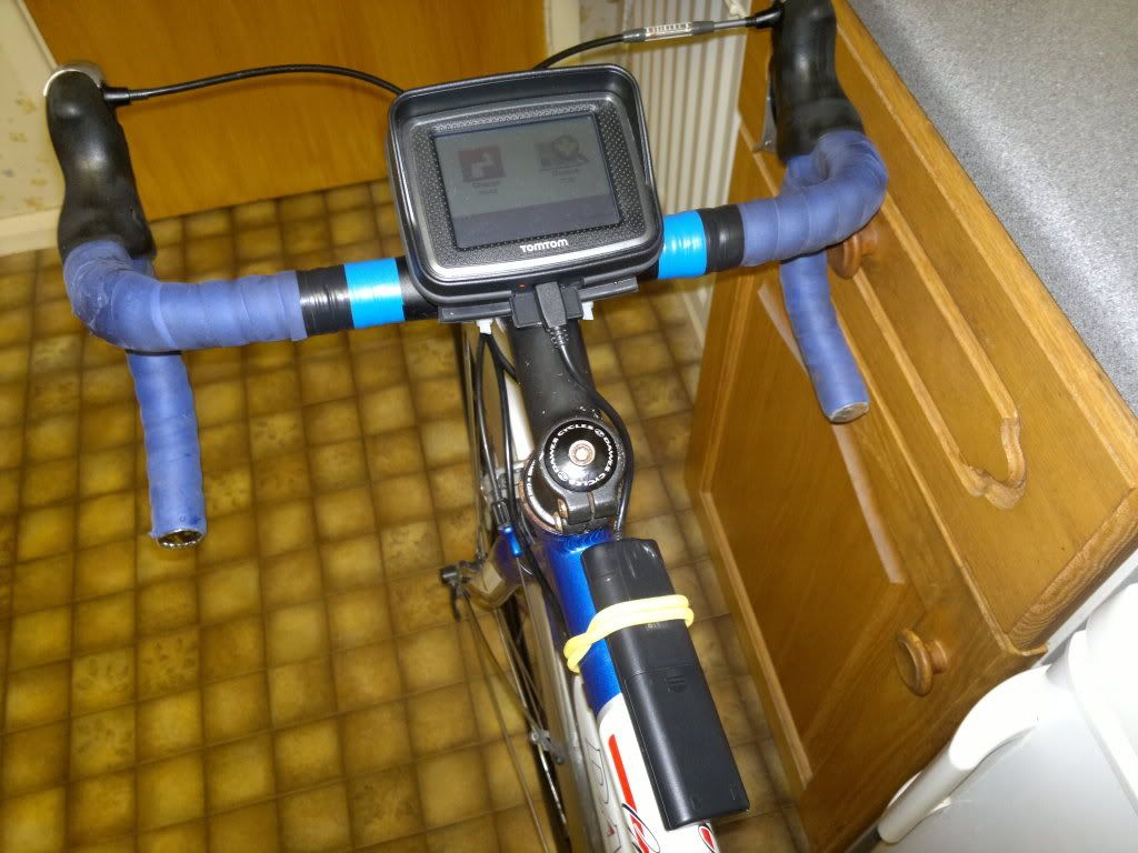
Can the TomTom be switched to bicycle mode?
We have a very cheap sat nav with a very small screen that cat be switched to bicycle. I found this out whilst in the car towing our caravan.


As I am one of the Flat Earth Society (I like OS maps) we found it very usefull when we rode of the edge of the known world (map).
We were on the road so I switched it on and soon the megamaniac inside told use not just where but also how to get back to where we started

.
This thing uses AA batteries.
Re: Bicycle Sat Navs
Posted: 9 Dec 2012, 8:34am
by Drake
Edwards wrote:Can the TomTom be switched to bicycle mode?
We have a very cheap sat nav with a very small screen that cat be switched to bicycle. I found this out whilst in the car towing our caravan.
As I am one of the Flat Earth Society (I like OS maps) we found it very usefull when we rode of the edge of the known world (map).
We were on the road so I switched it on and soon the megamaniac inside told use not just where but also how to get back to where we started
.
This thing uses AA batteries.
Must admit i hadn't thought of that,i'll check it out .
Ah ! So your the other member of the Flat Earth Society
Same as you with O/S maps . I also like looking at old O/S maps . Suprising how many footpaths seemed to have disappeared over the years .
P.S . I do hope your wife continues to improve after her ordeal .
Re: Bicycle Sat Navs
Posted: 9 Dec 2012, 10:23am
by graymee
Using your TomTom on your bike might work depending on how you want to use it and what info you want it to provide. It will be optimised for four wheel motorised transport and, although you can adjust the setting, may not give you the route you would choose if planning manually. You could select "avoid motorways" however it might still plan a route via busy dual carriageways and I wouldn't want to cycle on the A1 for example.
The map stored in the TomTom would, I'm fairly certain, not include cycle paths and other small roads that you might want to cycle on and therefore limit it's route options.
Battery life would also be an issue. Most TomTom's have rechargeable batteries and spend most of their life plugged into the car cigarette lighter socket.
If you just want to leave it switched off until you need it to confirm where you are it might work but for other uses it would be quite limited.
Re: Bicycle Sat Navs
Posted: 9 Dec 2012, 10:31am
by andymiller
It depends a bit on what you mean by a 'Bicycle SatNav'.
You can get gps devices that are weatherproof and you can mount them on your handlebars. You could also (probably) get a waterproof mount for your Tom Tom.
There are also gps devices that are marketed as 'bike-specific' but all this means is that the gps will also record (if you have the right sensors) cadence and heart-rate and output the results. Up to you to decide whether that's what you want. There are also gps devices that are glorified bike computers - but if you set up a traditional bike computer it will always give you more reliable results.
There's also gps mapping that shows cycle routes. I know this is available for Garmin devices but I don't know about others.
As far as auto-routing for cyclists is concerned you are limited by both the parameters used by your gps and by the data in your map. The day when you can get your gps to give you a route that's fast but not too busy, and scenic but not too hilly, is a long way off - your brain is always going to be better at doing that anyway. Providing you have a decent map on your gps it will always give you accurate information on where you are, and most of the time it will get you a reasonable route across a city you don't know.
I've been using a gps for cycling for years but I would always carry a paper/plastic map - if you want to work out where to go the easiest method is almost always to look on the paper map (at least outside towns). My gps mapping is a lot more detailed and a lot lighter, but zooming in and out on a small screen can be a real pain.
Re: Bicycle Sat Navs
Posted: 9 Dec 2012, 11:00am
by cycleruk
My TomTom does have a cycle specific mode but I have never used it.
I have used it once, in car mode, on an 100k Audax but in pre-planned route (itinerary) setting.
The biggest drawback with a TomTom is battery life and an external 5 volt (usb) source is needed.
I know that Chris Juden uses a Garmin Etrex 30 but I don't know how that compares with a TomTom for route planning etc.
Most cycle satnavs will allow some form of pre-planning on a PC and then load the route onto the bike satnav.
Re: Bicycle Sat Navs
Posted: 9 Dec 2012, 1:45pm
by al_yrpal
Personally, I dislike satnavs on bikes. I usually use google maps and print some out for my route then, if I am unsure of my position, I just look at the satnav on my phone to identify exactly where I am. Google maps now has a cycle mode on its satnav phone app, but its not great yet, needs more development. If its for a long tour I use bikeroutetoaster on the pc before I go, then print out the vital maps along the way and use those taking the phone along as a phone and position confirmer. Trouble is, battery life, although I get around that using a Tecknet battery recharger. This whole subject is quite complex, think I will do a blog page explaining it all at some point.
Al
Re: Bicycle Sat Navs
Posted: 9 Dec 2012, 2:06pm
by Galloper
I've used a Garmin 605 satnav for about 4 years now and it's an excellent aid. I will typically use it by planning out a route on my PC and then transferring that to the satnav which is a simple case of drag and drop. The satnav then gives visual prompts accomanied by a beep when a waypoint or direction change occurs. I should point out that this needs a set of installed maps.
One of the major advantages, especially when touring, is the facility to locate hotels, campsites, resteraunts etc. nearby. That's simply done using a couple of clicks, for example, to "Find hotel". The Garmin then brings up a list of hotels starting with nearest first. The same works for banks, garages and so on.
The one peculiarity I have found is that when I'm out and about and decide to head for home, or startpoint, it will select a "cyclists route" which can be considerably longer than a more direct route. I've worked around that by selecting the car as opposed to bike option.
The other point I would make is that on their own they're not good for route planning, maps are still the best for that.
There are lots of routes available to download from a variety of sites including the CTC. I've also noticed that a lot of Audax routes are also available for download.
Despite this, I think satnavs are an excellent tool and wouldn't be without mine.
Re: Bicycle Sat Navs
Posted: 9 Dec 2012, 2:23pm
by mrjemm
Got me wondering now if we're going to start seeing folk on cycles (or should I say, the other road users around them?) suffering from the curse of the satnav- seemingly random lane changes and replacing the mirrors/observations with the little bleeping screen.
I also use an eTrex 30, but have not tried, and as yet have no intention to try, the route planning thing, if it's avaialable, on it. Tis there as a back up to the OS I like to carry, and a fancy logging bike computer. Doesn't aid or assist me in any way really, and I could never see it replacing maps, but I do like toys. I use velomaps, and I think they've got hotels and stuff on them. Maybe try using that sort of stuff one day...
Re: Bicycle Sat Navs
Posted: 9 Dec 2012, 2:39pm
by Brian R Pateman
One of the things about cycling which appeals to me is that it is low-tech. and not reliant upon any source of energy apart from good old fashioned muscle power.
Having seen at first hand the problems caused by people unfamiliar with the area getting them self into tight spots with vehicles by blindly following their sat-nav, I prefer to use good old fashioned maps no matter if I'm on two wheels or four.
Self navigation seems very appropriate for a form of transport which is self-propulsion.
Re: Bicycle Sat Navs
Posted: 9 Dec 2012, 4:40pm
by Quaker Mike
I've always been a mapman. In my impoverished adolescence I used the map pages from an old AA year book (in those far-off days there was little traffic, so almost any road was a cycle route). When I started work I graduated to Barts half-inch maps, beautifully drawn and ideal for the mileages I could then cover. When Barts went the way of all flesh, I moved to 1" OS, and found I had to carry three or four even for some day rides. Now I use metric OS maps and seldom fall off the edge.
But I've also always been a 'I wonder what's down there' rider, i.e. I'll work out a potential route, and take the appropriate map(s), but then see an interesting byway or fingerpost, and take off into the unknown. I used to get irritated in a netwirk of strange lanes when I had to stop frequently to check the map, and even more annoyed when the map ran out. So I welcomed satnav, and wouldn't now be without my latest toy, a Garmin Edge 800, which not only tells me all the turns, but recalculates the route to my ultimate destination when I take off on a "I wonder what's down there" jaunt, as well as recording everywhere I've been for future use.
Of course, like everything else, you need to use a certain amount of common sense. If it tries to send me on a major road I either reprogram it from my map, or if I'm off the map, branch off onto the next byway - it soon finds an alternative route. It all adds to happy cycling.
Re: Bicycle Sat Navs
Posted: 9 Dec 2012, 7:46pm
by Ayesha
It works a bloody treat. Don't let anyone take the P.
The difference between this and a Garmin is, with a Garmin, if you go off course, the Avg speed value is now not correct for the Audax route. With a TomTom, you work on an ETA based on 20 kmh average speed. If you go off course, the ETA recalculates to include the extra road miles travelled.
PS. Garmin eTrex and Edge series units are NOT SatNavs. They are 'GPS enabled bicycle ( or exploring ) data loggers.' If recording where you've been and working out your performance is your thing, buy a Garmin.
If you want a "get me there" SatNav, Garmins don't perform very well unless you are prepared to spend £450 on a Zumo motorbike unit. The TomTom Rider does what I want, ( get me round an Audax ) and I don't use Garmin any longer.
Re: Bicycle Sat Navs
Posted: 9 Dec 2012, 8:43pm
by corshamjim
My Garmin Dakota 20 isn't a dedicated cycling sat-nav, more of a general purpose outdoor gps with mapping. I do find it very useful for planning and following routes. It does have lots of navigational foibles though so I usually plot a few waypoints along the route I want to take to make sure it will navigate me that way before I set off. Even if I know the route, the indication it gives me of miles to destination is very useful for pacing myself. Sometimes it's just fun to follow the route it chooses to takje me, but it doesn't seem to know what a hill is!
Re: Bicycle Sat Navs
Posted: 10 Dec 2012, 12:19am
by Vantage
I use a Garmin eTrex20. I decided to buy it after having panic attacks as a result of not being able to read a map properly and getting lost.
Garmin don't supply the units with anything other than a basic map which is completely useless, you need to either buy a proper one at an extortionate cost from Garmin and load it into the gps or use a free one like Velomaps or osm types (they're just as good, if not better).
Mine gives me several different views including "automotive" which is similar to what you see on a car satnav. It runs for about 20 - 25 hours on 2 AA batteries which you can find anywhere and doesn't weigh a ton or look an eyesore on the bike. It's also waterproof (to a certain extent, rain is definately not a threat) and built to handle a few knocks.
The Dakota and eTrex models are more or less the same with the exception that the Dakota's have touchscreens and whether you prefer that over the clicky buttons of an eTtex would be a personal thing I guess. I chose buttons as that way, I don't have to remove my bulky gloves in freezing weather to change something or have to contend with raindrops messing up the screen (some users reported a problem with this on the Dakota's).
I have no idea what half the functions on my little gps do and nor do I care, it does its job of letting me know where I am and getting me to a destination. I rarely use auto-routing as I'd rather plan my own interesting (and sometimes plain stupid) routes and destinations. Only when I get stuck do I rely on auto-routing and the few times I have, it's gotten me home, despite being a Garmin. If it tries to take me on a route I don't like the look of, I take a different road and it automatically re-routes, simples.
Paper maps are nice and you can draw your favorite routes on them, the same applies to gps maps but with some differences.
You can save several different maps on a gps and choose whichever one you want at any time in whatever scale you want.
All your favorite routes can be saved, in the same way you save a file on your computer.
All your favorite destinations can be saved aswell as your favorite spots, shops or whatever else you want.
Gps units, they really are brilliant little toys
Re: Bicycle Sat Navs
Posted: 10 Dec 2012, 11:01am
by Ayesha
I had a Garmin eTrex Legend and then an Edge 605. I loaded Topo GB.
I live in eastern Birmingham and have the M42, M6 and A38(M) around me, as well as some quite dodgy major roads. Using Autorouting was a nightmare. To stay off the motorways, it was either 'by bike' or 'Avoid Highways'. Both ways send me round and about miles further than I would have ridden by local area knowledge. It had weird ideas of what a 'Highway' was and weird ideas of roads suitable for cyclists.
I bought that TomTom and gave the Garmins away. I'm happy as Larry.
However, I did use the Garmins with pre-planned routes. As long as the viapoints are not too numerous and in sensible positions, both units worked fine. It was 'impromptu journeys' where the Garmins failed.
PS. I'm taking the title of this thread at face value. "Bicycle Sat Navs". There aren't any. The closest is Garmin Edge with OpenCycleMaps, with VERY carefully arranged settings.
OR, a motorcycle unit from TomTom ( Rider ) or Garmin ( Zumo ) with external battery reserve ( and a LIGHTWEIGHT mount ).

These units have TT maps regular udates or Garmin nuMaps regular map downloads.
They are both quite pricey.