We're off for a two week family tour in Brittany. The idea is to do the velodysse route but we've not really had time to plan anything due to a very busy period. So we're doing it very late.
First thing needed is a good map for cycling. Second is a good guidebook. If anyone can offer recommendations for each of these we'd be grateful.
BTW 5 year old, freewheeling child (unlikely to attach to an adult's bike) means distance each day will not be great. So I doubt we'd get to Nantes and back in two weeks. I suspect this means one map probably covers it needs. Arriving at Roscoff by ferry without car.
Brittany - best maps and guidebooks?
Re: Brittany - best maps and guidebooks?
Maps - IGN TOP100 (the old series verte) 1:100,000 available from several sources http://www.stanfords.co.uk/France-IGN-1 ... SI00000297

Re: Brittany - best maps and guidebooks?
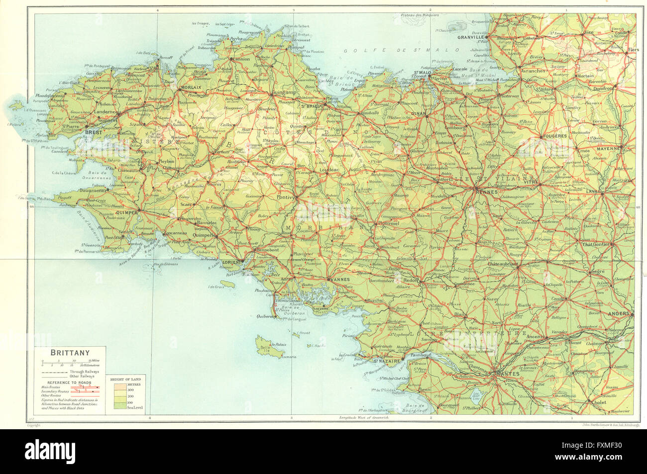
I have posted before that I love Muihead's "Blue Guides" because off teh level of information, and being able to compare historically, hence:
Muirhead's Guide to Brittany The Blue Guide 2nd Impression 1925
This is a typical Muirheads map of a town - contrasting the changes and what has remained lends a whole new level to touring
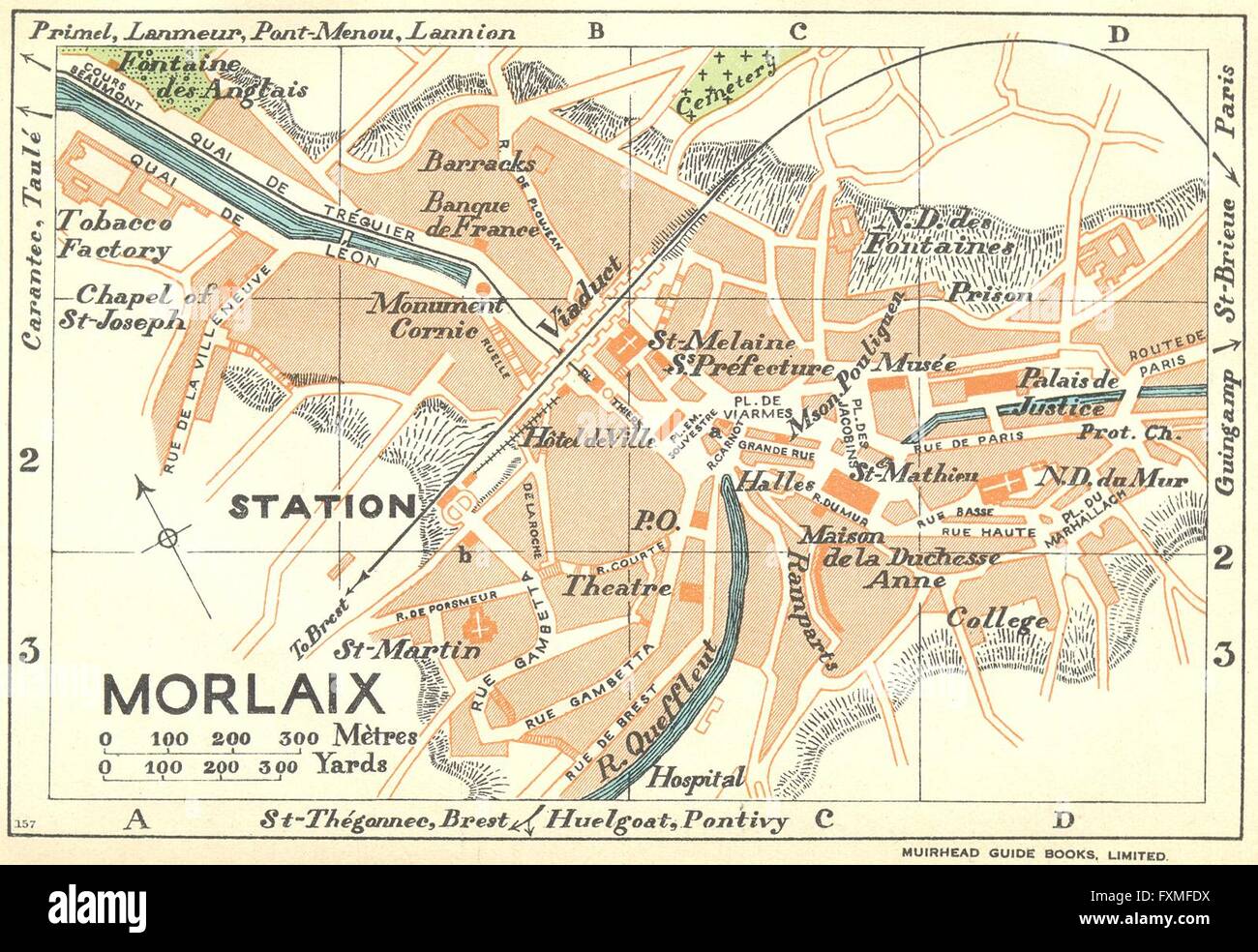
Or see how close you can get following the 1926 road network:
Muirhead's Guide to Brittany The Blue Guide 2nd Impression 1925
This is a typical Muirheads map of a town - contrasting the changes and what has remained lends a whole new level to touring
Or see how close you can get following the 1926 road network:

Re: Brittany - best maps and guidebooks?
I prefer the yellow Michelin maps 200000 but the IGN 1000000 may be a good choice here as you'll be on paths some of the time.
I have the Nantes Brest canal Brittany guide in English (it's a reasonable chunk of the route). I think I have the voies vertes guide in French. I'm trying to remember if there's a velodysee guide too.
As ever Stanfords are excellent if you can track down what you want in their catalogue but better if you are near to their London or Bristol shops.
For general guide books I like the rough guide to (Brittany and Normandy in this case). They usually cover the smaller towns and not just bigger places which is more use for cyclists. Obviously these days you may prefer the kindle version.
Just read the bit about the 5 year old- the 100000 and the canal guide are good choices as I expect you'll be mostly on the canal route.nb the first bit to Cathaix is a voie verte and I haven't done that- we taxied that part as the kids were cream crackered and we'd cycled from Redon (got the train to there).
Re: Brittany - best maps and guidebooks?
I've just cycled across France and used Google maps on my tablet and the Michelin yellow maps mentioned above.
Given your slow pace you may be able to get away with the IGN as you won't be needing many.
Google is very useful as you can do all sorts of searches. My most popular was for Lidl, which like in UK, is a bargain supermarket. I bought lunch and dinner there.
As an aside, The Michelin used to do yellow regional maps (Brittany, Normandy, etc) which were a bargain as they only cost a bit more than the standard size yellow maps, but covered about 4 times the area. I don't think they make them anymore.
-
Tangled Metal
- Posts: 9509
- Joined: 13 Feb 2015, 8:32pm
Re: Brittany - best maps and guidebooks?
My local independent bookstore sells Michelin and there are two yellow maps to cover Brittany. Quite a large scale though. More a set of roads like an atlas so really only good if you're riding on roads. We plan on using the greenways, canal towpaths, disused railway lines and the like.
I think IGN do 1:75,000 scale maps which seem good for cycling. A few guidebooks for cycling use IGN 1:80,000 scale maps. There are of course IGN 1:25,000 scale walkers maps too.
I think most Michelin maps seem to be 1:100,000 to 1:200,000 scales. I think they're a bit too small scale.
I think IGN do 1:75,000 scale maps which seem good for cycling. A few guidebooks for cycling use IGN 1:80,000 scale maps. There are of course IGN 1:25,000 scale walkers maps too.
I think most Michelin maps seem to be 1:100,000 to 1:200,000 scales. I think they're a bit too small scale.
-
bretonbikes
- Posts: 682
- Joined: 3 Dec 2008, 12:35pm
- Contact:
Re: Brittany - best maps and guidebooks?
I use personally and for our customers the Michelin orange regional series - For Brittany you want 512. They come as 'indechirable' - waterproof, and they are pretty indestructible. You'll get one in any supermarket or 'Tabac'. They also mark the cycleroutes as green and white lines.
I know the scale of 1:200000 seems a bit large and some small lanes are missing, but the advantage is that they are easy to follow. The white roads vary subtly in width and so routes between villages jump out at you - hard to describe but once you've cottoned on it's easy. They also tend to mark the villages that are on signposts (unlike IGN). In contrast the IGN 100000 series have more 'white' roads, but they are a complete maze and spiderweb that's both difficult to follow and also gives no indication as to which roads are more important than others - some farm track being the same width as a two lane road - I find them pretty hopeless - you'll also need more of them...
If you are doing the Nantes-Brest canal there's a bit of bumph, a map and a couple of links here - http://www.bretonbikes.com/brittany/nantes-brest-canal
There is an excellent guide you can get at the Tourist offices but the best one for the Nantes Brest is now out of print - I've only a few left at our campsite. We're hassling them to update and reprint but it's not easy...
Feel free to PM if you want free advice.
38 years of cycletouring, 33 years of running cycling holidays, 8 years of running a campsite for cyclists - there's a pattern here...