Page 65 of 108
Re: Cycle Travel Question
Posted: 30 Oct 2020, 10:52pm
by andrew_s
It doesn't allow routing with no access. If you try to force it by putting the start or end on the non-permitted route, the marker just jumps on to the closest permitted route.
This was a problem on estate tracks in Scotland, that are, or were, frequently tagged as footpaths, with no access permission for cycles, but it seems that there's been either a bulk change of the tags, or that cycle.travel is now allowing routing on all Scottish paths.
[edit] It's retagging: c.t still won't use the track down the side of Loch Garry.
Interestingly, the unrideable sections are showing up as cycleways

Example: Glen Brown, between Dorback Lodge and Tomintoul, on the cycle.travel recommended route.
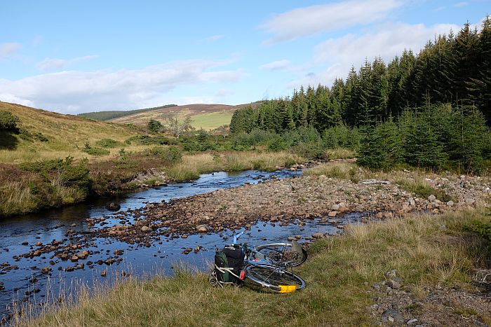
You follow the valley bottom, crossing the stream multiple times, then turn right and thrash up the hillside just after the trees end.
It's been used by a land rover occasionally, but not consistently enough that these's much of a defined track.
Re: Cycle Travel Question
Posted: 31 Oct 2020, 8:27am
by francovendee
There are a lot of cycle tracks/routes signposted here in the Vendee and are all OK to ride if at times a bit rough.
All routing apps avoid a perfectly good track that crosses a small stream via a wide wooden bridge.
I can see the track as a dashed line but all apps refuse to use it although it is part of the VendeeVelo network and sign posted.
I've tried it on Cycle Travel and it's the same. There must be something in the mapping that prevents apps using this track?
Re: Cycle Travel Question
Posted: 31 Oct 2020, 9:52am
by Richard Fairhurst
Can you give the coordinates (lat/long) for the track?
Re: Cycle Travel Question
Posted: 31 Oct 2020, 4:21pm
by francovendee
Richard Fairhurst wrote:Can you give the coordinates (lat/long) for the track?
46.6486,-1.8496
46.664,-1.8454.
You can work it out that there is a more direct route than the apps shows.
It's really odd as it is signposted and quite a number of people use it. The small river the track crosses has a nice bridge spanning it not stepping stones or a ford. It's no problem if you follow the signs but curious why apps don't pick it up.
Re: Cycle Travel Question
Posted: 16 Nov 2020, 4:53pm
by Angstrom
Hello,
I use BikePGX, as advised by Richard. I don't understand why importing a GPX file in BikeGPX from CT dos not work.
Strangely, BikeGPX only imports from url. It does work from other site that offer sharing a route via url, but it doesn't from CT. I have imported successfully to other sites from CT via the copied URL so this is very odd.
I know this is more a BikeGPX question than CT, but there might be a work-around that I haven't found out which could be shared.
Thank you.
PS: I have found out that downloading the file to my Android phone, I can then open and choose BikeGPX as an app with which to open the file. So it can work, with one extra step.
Re: Cycle Travel Question
Posted: 16 Nov 2020, 7:36pm
by Richard Fairhurst
Angstrom wrote:I know this is more a BikeGPX question than CT, but there might be a work-around that I haven't found out which could be shared.
Curious. I've just emailed the BikeGPX creator to see if he can shed any light.
francovendee wrote:Richard Fairhurst wrote:Can you give the coordinates (lat/long) for the track?
46.6486,-1.8496
46.664,-1.8454.
You can work it out that there is a more direct route than the apps shows.
It's really odd as it is signposted and quite a number of people use it. The small river the track crosses has a nice bridge spanning it not stepping stones or a ford. It's no problem if you follow the signs but curious why apps don't pick it up.
In cycle.travel's case it's because the surface quality for the track hasn't been marked in OSM, and nor has the signposting. cycle.travel is a bit suspicious of unmarked tracks in France as they can be thoroughly uncyclable (and there's often a quiet lane alternative!).
I've just made the change in OSM based on your information so cycle.travel should be a bit happier to route across it at the next map update. And I now have a quieter and faster server so map updates can be a little more regular!

Re: Cycle Travel Question
Posted: 17 Nov 2020, 8:22am
by francovendee
Thanks Richard, It may help some souls avoid the road.
You're right about tracks here having mixed surfaces. One time we followed a Google route that took us to a stretch of marshy ground which stretched for at least half a mile. We tried it pushing the bikes but the water kept getting deeper so we turned back and went a different way.
Other times a track turns out to be as smooth as a road, you just can't tell.
Re: Cycle Travel Question
Posted: 17 Nov 2020, 8:57am
by Angstrom
Richard Fairhurst wrote:Angstrom wrote:I know this is more a BikeGPX question than CT, but there might be a work-around that I haven't found out which could be shared.
Curious. I've just emailed the BikeGPX creator to see if he can shed any light.
I hope you get an answer. I emailed him twice but never got an answer. I volunteered to help translate in French his very good app.
francovendee wrote:Richard Fairhurst wrote:Can you give the coordinates (lat/long) for the track?
46.6486,-1.8496
46.664,-1.8454.
You can work it out that there is a more direct route than the apps shows.
It's really odd as it is signposted and quite a number of people use it. The small river the track crosses has a nice bridge spanning it not stepping stones or a ford. It's no problem if you follow the signs but curious why apps don't pick it up.
In cycle.travel's case it's because the surface quality for the track hasn't been marked in OSM, and nor has the signposting. cycle.travel is a bit suspicious of unmarked tracks in France as they can be thoroughly uncyclable (and there's often a quiet lane alternative!).
AS an enhancement to deal with these cases, it might be a good idea to have CT consider the length of a doubtful passage. I find that for those who find CT particularly suited to their style of riding, getting off the bike for a very short passage in case it isn't comfortably ridable isn't so much a problem, if one is being properly warned of it (there are definite cases where this would NOT be doable, such as tandems, tricycles, children, heavy loads, etc.)
It might be possible to add a special icon for such cases with a warning sign and brief words of caution. By definition, it would not be a long stretch of path (I realize how fuzzy this could be, with different meanings for different people).
Just an idea.
Re: Cycle Travel Question
Posted: 19 Dec 2020, 7:30pm
by Boring_Username
I have only just discovered cycle.travel as a result of becoming frustrated with Ride with GPS's increasingly bizarre route suggestions (no, I am not going to turn off this reasonable road to follow a parallel side road for only 10 metres before returning to the original road). For some reason this problem seems to be steadily worsening over the last few months.
I have to say I am pretty impressed. Have for the first time uploaded a TCX file to my Wahoo Bolt for tomorrow's outing, so fingers crossed!
Re: Cycle Travel Question
Posted: 3 Jan 2021, 2:11pm
by doodah
I suspect the answer will be -"No". So here is the question.....
Can Archies Campsite app be imported / overlaid into cycle.travel?
"Why?" I hear you ask. The reason is that I make my route on ct and then export it as gpx to Basecamp where I have Archies imported.
I then open the route and overlay the Archies app of the country that I will be cycling through. This then shows all the campsites. I select all the campsites on and near my route and put them as waypoints into my route and save.
When I open my route - using Garmin Oregon 600 - I have a gpx route with all the waypoints (campsites) nearby. Each campsite has all the info eg. telephone number, opening times inc seasonal, location co ordinates inc elevation and facilities. A boon.
Brilliant when I was doing the first half of the EV6 and going from Narbonne to Europoort last year.
The problem I have now is that my Mac has been updated with Big Sur and consequently made Base camp reallllly sloooooow - not just for me but for all users. It may seem a faff to some of you but it works a treat for me and gives a lot of flexibility and confidence to stray from your chosen route, if so desired.
So can Archies be imported / overlaid into cycle.travel?
Phew! Thank you.
Doodah
Re: Cycle Travel Question
Posted: 3 Jan 2021, 2:17pm
by Jdsk
doodah wrote:The problem I have now is that my Mac has been updated with Big Sur and consequently made Base camp reallllly sloooooow - not just for me but for all users
1 New update with reported fix:
https://www.gpsrchive.com/Discussion/viewtopic.php?f=59&t=10592 From another site:
"I have found a solution for me, MacBook Pro Late 2013: Select Menu "View" > "Show 3D Maps only" (translated from the German version, maybe the English version says something different). Then BaseCamp runs perfectly again in Big Sur 11.0.1."Jonathan
Re: Cycle Travel Question
Posted: 3 Jan 2021, 3:19pm
by doodah
Jdsk wrote:doodah wrote:The problem I have now is that my Mac has been updated with Big Sur and consequently made Base camp reallllly sloooooow - not just for me but for all users
1 New update with reported fix:
https://www.gpsrchive.com/Discussion/viewtopic.php?f=59&t=10592 From another site:
"I have found a solution for me, MacBook Pro Late 2013: Select Menu "View" > "Show 3D Maps only" (translated from the German version, maybe the English version says something different). Then BaseCamp runs perfectly again in Big Sur 11.0.1."Jonathan
Thanks a million for that 1st link Jonathan. It has worked a treat and normal service can resume for me - brilliant.
I obviously didn't spot / find that link but I did see the other link. It was still crappy and inadequate. It just goes to show - the clever people are not the ones who know the right answers but ask the right questions
Many thanks.
Ian
Re: Cycle Travel Question
Posted: 3 Jan 2021, 3:30pm
by Jdsk
: - )
Jonathan
Re: Cycle Travel Question
Posted: 3 Jan 2021, 8:11pm
by doodah
This is not a cycle travel question / problem, but after Googling the problem for answers, I cannot think of a better forum to help me other than Garmin - if I live that long!
I send the gpx track from ct to google - fine. I then want to send the track to my device - as per screenshot below.
The next action I am instructed to take is as per screenshot below.
I already have Garmin Express installed and have deleted / installed it numerous times - just in case.
My mac recognises my Garmin Oregon as per screenshot below.
I have changed the usb after reading on here that might help; I have closed down all others apps and even thought about hoying a brick at next door's cat but I cannot get the file to send. Garmin Connect recognises the file, the computer and Garmin recognise the Oregon but the two will not 'talk' to each other.
Can anyone help - Jdsk?
Thank you
Ian
Re: Cycle Travel Question
Posted: 3 Jan 2021, 8:19pm
by Jdsk
The biggest problems I've had with Garmins and USBs have been with the cable! This has never been fully explained but it does work better with official Garmin cables than some others. This only applies to data transfer rather than charging. It's been repeatedly reported on the Garmin support site.
I suggest trying the following and then reporting back:
With each of many cables as possible see if they:
1 Support charging.
2 Allow the Garmin device to mount as a volume in the Finder.
3 Allow connection to Garmin Express (the test that you've just done with one cable).
Jonathan
PS: I nearly always mount my Edge 1000 as a volume and drag files into the privileged folder rather than using Garmin Express on the Mac.