I picked up the Byeways map for the East Midlands about a month ago from the counter of the Oakham Museum after noticing many brown signs on local small roads.
It was only a couple of quid (v cheap for such a big area) and they had about 6 more on display (presumably still there if anyone wants one).
I thought that I would get the rest of the set online but hadn't got around to it and it seems from this thread that I probably wont be able to

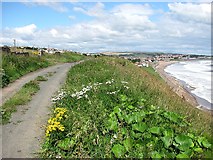
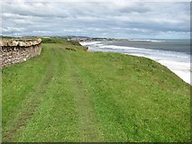
The routes seem to be just what I want - minor, less trafficked roads linking together into long distance routes with the bonus of brown signage at those junctions not vandalised or missing - not too much of a problem here in Rutland.
I have given up with Sustrans completely. The routes seem fine if you are on a mountain bike but I ride a recumbent trike most of the time and find that the off-road surfaces and multitude of obstructions to "stop use by motorbikes etc" make them completely unusable for people with machines like mine (or trailers or big panniers or tandems etc etc). The only people not inconvenienced seem to be youfs on (stolen?) mopeds, scooters etc who make other entrances / exits through hedges etc and hoon about on Sustrans routes in dodgy built-up areas.
Anyone else know sources for other maps in the series (other than the previously mentioned "Hut")?
Chris Chapman (aka Kaptain Kreman)