Page 1 of 1
long distance canal route
Posted: 14 Nov 2019, 8:58pm
by Sue60N
For a long time I've had a notion to do a longish distance by canal towpath - Kendal-London or Ripon-London or vice-versa. I'm sure it's feasible but the Waterways website does not make it easy to suss out where towpaths are interrupted and where there are suitable overnight/hostel or camping stops. Has anyone done this or know of any easy planning tools?
Re: long distance canal route
Posted: 15 Nov 2019, 8:41am
by millimole
Sue60N wrote:For a long time I've had a notion to do a longish distance by canal towpath - Kendal-London or Ripon-London or vice-versa. I'm sure it's feasible but the Waterways website does not make it easy to suss out where towpaths are interrupted and where there are suitable overnight/hostel or camping stops. Has anyone done this or know of any easy planning tools?
I can't help directly but in my role as a volunteer with The Canal & Rivers Trust I can tell you that I've found tgat what you are planning isn't that unusual.
I encounter, during my one day a week stints, maybe two or three people a season who are passing through Leicester doing long distance journeys on foot or by bicycle.
My only advice to to would be to plan to do /very/ much lower distances than what you might on road, or cycle route.
Towpath surfaces are very variable, and you will encounter walkers, children, anglers, obstructions, diversions, and lots of people to stop and talk to.
I envy you - enjoy!
I'm a trendy consumer. Just look at my wobbly using hovercraft full of eels.
Re: long distance canal route
Posted: 15 Nov 2019, 12:24pm
by RickH
The Lancaster Canal is severed by road building a few miles north of Carnforth and much of the section north to Kendal is in disrepair, is non-existent &/or has several more severance by major roads (the M6 twice).
It is also separated from the rest of the canal network at Preston. When it was a working canal goods were transported across Preston, & the Ribble Valley, on a tramway. The Tramway route is currently closed due to the dangerous state of the bridge across the river (although there are alternative river crossings). There isn't much evidence of the canal south of Preston until you get to near Chorley where there is a very short section left between where it was severed by the M61 to the Leeds Liverpool Canal.
From there there is a continuous route through the canal network (apart from a few short sections where there is no towpath through tunnels) but the towpath varies from really good to a "I really wouldn't recommend riding it, especially after heavy rain!" state. Oh, and the occasional barrier that can cause problems, particularly if you are carrying luggage &/or have wide handlebars!
Re: long distance canal route
Posted: 15 Nov 2019, 1:43pm
by Richard Fairhurst
There've been a few threads on this in the past, e.g.
viewtopic.php?t=107477 .
Bear in mind that many of what you might consider "waterways" are actually rivers and don't have a cyclable (or indeed any) towpath. For example, you'll get about one mile out of Ripon on the Ripon Canal before meeting the River Ouse, which doesn't have a rideable towpath.
There are also plenty of canals with mudbath towpaths that will be no fun to ride along, such as the Shropshire Union.
Re: long distance canal route
Posted: 15 Nov 2019, 3:40pm
by mjr
Richard Fairhurst wrote:There are also plenty of canals with mudbath towpaths that will be no fun to ride along, such as the Shropshire Union.
Is there no duty to keep them passable by horses any more?
Re: long distance canal route
Posted: 15 Nov 2019, 5:08pm
by Richard Fairhurst
Waterways World did a big, well-researched article on modern horse-boating the other month. It basically doesn't happen any more other than seven localised operations, such as the one at Llangollen. Towpath vegetation is an issue, but the real problem is the number of moored boats - because the clutter on the roof gets in the way of the rope.
Sue Day, who's pretty much the one remaining long-distance horse-boater, was previously quite hostile to towpath improvements for cyclists - when I was editing WW I remember her getting agitated about the NCN 66 improvements on the Rochdale Canal in Manchester. But the article actually says that she's ok with cyclists now, because we lobby CRT to get rid of motorbike barriers. I remember Sue's crew once taking a hacksaw to a (wooden) barrier on the Grand Union so that they could get the horse past!
Re: long distance canal route
Posted: 15 Nov 2019, 8:20pm
by millimole
Richard Fairhurst wrote:There've been a few threads on this in the past, e.g.
viewtopic.php?t=107477 .
Bear in mind that many of what you might consider "waterways" are actually rivers and don't have a cyclable (or indeed any) towpath. For example, you'll get about one mile out of Ripon on the Ripon Canal before meeting the River Ouse, which doesn't have a rideable towpath.
.
This is true of the River Soar (Aka Grand Union Leicester Line) between Birstall and Trent Lock, and the River Trent.
This isn't the obvious route for your intended travels, but would be more rural I suspect. I /think/ Sustrans route 6 might be an alternative where there is no towpath.
I'm a trendy consumer. Just look at my wobbly using hovercraft full of eels.
Re: long distance canal route
Posted: 17 Nov 2019, 7:30pm
by Sue60N
Thanks everyone for the info - Can only assume that there really isn't any planning tool of any sort available. Great winter project I guess!
Re: long distance canal route
Posted: 17 Nov 2019, 7:54pm
by RickH
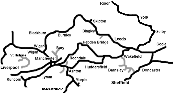
Pennine Waterways have virtual photo tours of many, if not all, of the canals on their "patch" which may give you an idea of the state of the towpaths. Some may have been improved since but none should be significantly worse.
I've not looked to see if there are similar resources for elsewhere on the network.
Re: long distance canal route
Posted: 17 Nov 2019, 8:23pm
by Sue60N
Thats really useful RickH - will check out the other regions too.